Mission planner
The mission planner is the heart of Downlink — type an address and it produces a terrain-following flight grid your DJI drone can fly, with the overlap, ground sample distance (GSD), and photo-interval math done live.
Where to find it #
Sidebar → Plan — or start it from a job or client so the property loads automatically.
Plan a mission, step by step #
- Find the site — type an address in the search box, or open the planner from a client's property so it's already centered. The parcel outline is pulled in automatically where county data is available.
- Draw the area — trace the boundary you want to cover, or use the pulled parcel. Downlink fills it with a lawnmower (single-direction) or crosshatch (double-grid) pattern.
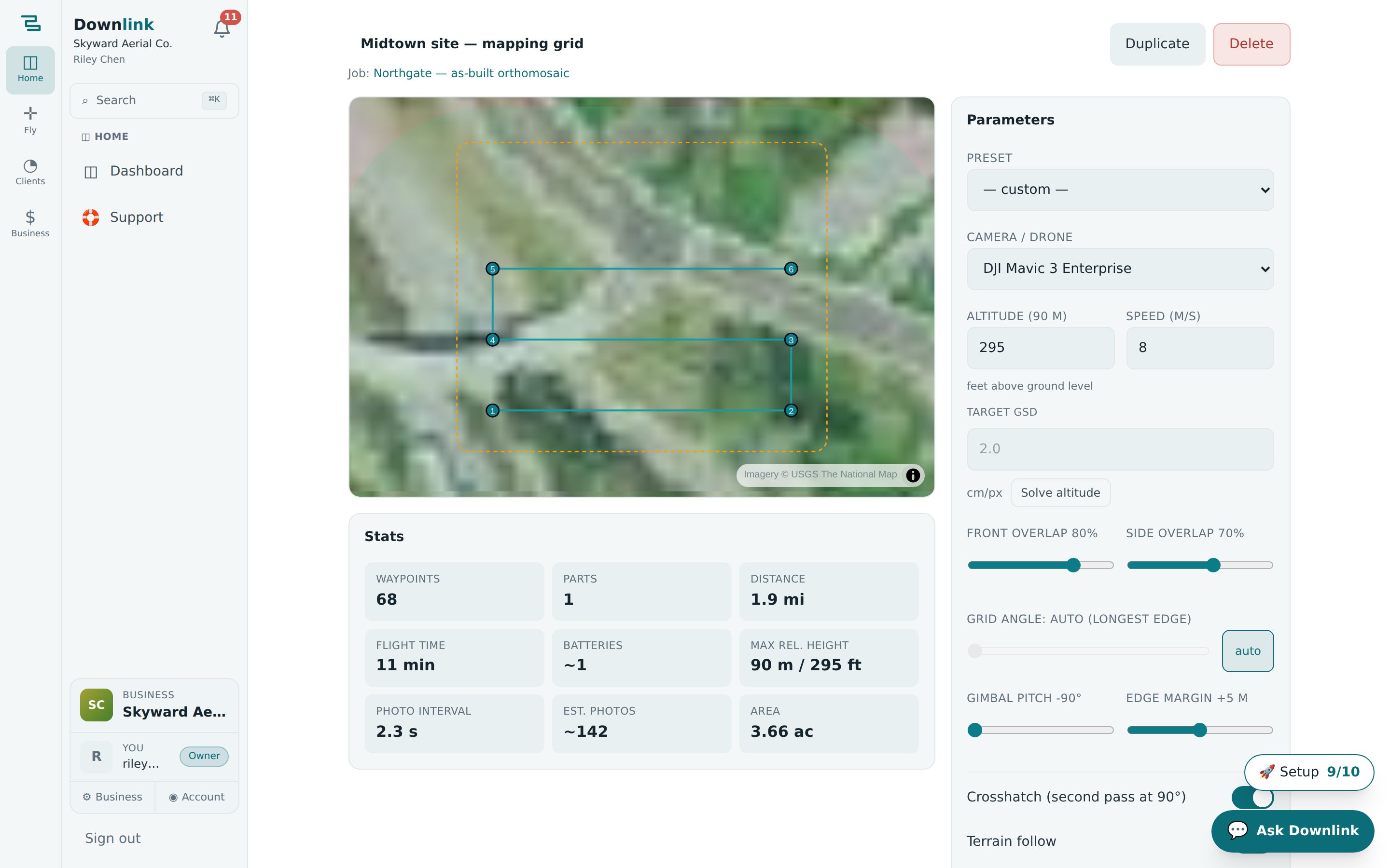
- Dial in the shot — set your camera/drone, target GSD or altitude, and front/side overlap. The readouts update live so you hit spec before you leave the driveway (see the example below).
- Let it follow the terrain — altitudes adjust to the ground so GSD stays constant over slopes.
- Name & save — give the mission a name and optionally attach it to a job so it lives on that record.
- Export — head to Send to controller to get the DJI Fly KMZ.
A 6-acre residential lot survey for the Bluebird Realty listing:
| Setting | Example value | Notes |
|---|---|---|
| Mission name | Bluebird — 1200 Market St survey | Shows up on the job and in your mission list. |
| Attach to job | Bluebird Realty — aerial survey | Optional, but keeps the flight with the record. |
| Pattern | Crosshatch (double grid) | Best for 3D/photogrammetry; lawnmower for flat orthos. |
| Front / side overlap | 80% / 70% | Higher overlap = cleaner stitch, more photos. |
| Target GSD | 1.2 cm/px | Drives the altitude; terrain-following keeps it constant. |
| Drone | DJI Mavic 3 Enterprise | Sets the sensor for the GSD/interval math. |
DJI Fly caps a mission at 200 waypoints. Downlink auto-splits large grids into multiple missions cleanly at line boundaries — never mid-pass — so you just fly them in order. You don't have to do anything.
Corridor missions (Max plan) #
For roads, rail, powerlines, and pipeline, switch to a corridor mission: trace the line and set a buffer width, and Downlink lays down a there-and-back pattern that follows it. Corridor planning is included on the Max plan.
Before you commit a day to a flight, open Airspace & weather for the site — you'll get the FAA verdict (Class G? LAANC ceiling?) and the ranked flight windows for the next 7 days.